
You are on the page: Home page ➤ Photo galleries of Nepal

Bodhnath Swayambhunath Elephant safari in Chitwan Annapurna trekking Kathmandu

Nepal – photo gallery


Kathmandu
Bodhnath    Swayambhunath    Pashupatinath
Thamel    Durbar Square    Patan    Bhaktapur    Pharping
Mountain flight to Everest from Kathmandu
Kathmandu to Pokhara by bus

Pokhara
International Mountain Museum in Pokhara

Lumbini (the birth place of Buddha)

Chitwan National Park
Canoe safari     Elephants bathing     Jeep safari     Elephant ride (safari)


Annapurna trekking

   The Annapurna Circuit is a popular name for a trek within the Annapurna mountain range of central Nepal. The total length of the route varies between 160–230 km, depending on where the motor transportation is used and where the trek is ended. The trek rises to an altitude of 5,416m on the Thorung La pass, touching the edge of the Tibetan plateau. 5500 photos of Annapurna Circuit were made in 2009.


Dumre to Besishahar
Besishahar     Besishahar to Bhulbhule road
Bhulbhule     Bhulbhule to Ngadi road
Ngadi     Ngadi to Bahundanda road
Bahundanda     Bahundanda to Syange road
Syange     Syange to Jagat road
Jagat     Jagat to Tal road
Tal     Tal to Dharapani road
Dharapani     Dharapani to Danaque road
Danaque     Danaque to Timang road
Timang     Timang to Chame road
Chame     Chame to Pisang road
Pisang     Pisang to Humde road
Humde     Humde to Bhraka road
Bhraka     Bhraka to Milarepa cave trekking     Bhraka to Manang road
Manang     Manang to Yak Kharka road
Yak Kharka ('Yak Pasture')     Yak Kharka to Letdar road
Letdar     Letdar to Thorong Phedi road
Thorong Phedi     Thorong Phedi to High Camp road
Thorong Phedi High Camp     High Camp to Thorong-la road
Mustang:
Thorong-la (Thorong pass), 5416 metres     Thorong-la to Muktinath road
Muktinath      Muktinath to Kagbeni road
Kagbeni      Kagbeni to Muktinath road      Kagbeni to Jomsom road
Jomsom    Mustang Eco-museum    Flight from Pokhara to Jomsom    Jomsom to Kagbeni road    Jomsom to Marpha road
Marpha     Marpha to Larjung road
Larjung     Trekking from Larjung to Padmasambhava cave     Larjung to Ghasa road
Ghasa     Ghasa to Tatopani road
Tatopani     Tatopani to Shikha road
Shikha     Shikha to Gorepani road
Gorepani     Sunrise at Poonhill     Gorepani to Birethanti road
Birethanti


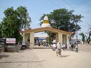
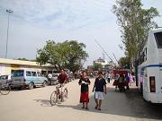
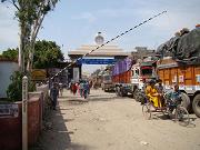
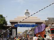
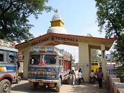
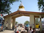
Sonauli (Sunauli)
well known transit point between India and Nepal
nepal001.htm nepal002.htm nepal003.htm nepal004.htm nepal005.htm nepal006.htm nepal007.htm nepal008.htm nepal009.htm nepal010.htm nepal011.htm nepal012.htm nepal013.htm nepal014.htm nepal015.htm nepal016.htm nepal017.htm nepal018.htm nepal019.htm nepal020.htm nepal021.htm nepal022.htm nepal023.htm nepal024.htm nepal025.htm nepal026.htm nepal027.htm


NEPAL

   Nepal has some of the most dramatic mountain terrain in the world. The massive Himalayan mountain range was thrust up out of the ocean 50 million years ago when India collided with the rest of the Asian land mass. Today, Nepal is nearly 75% mountain, and it contains eight of the world's 10 highest peaks. And they just keep on getting bigger — tectonic plate movements means that the mountains continue to grow at the rate of several centimeters per year.

   At the northernmost reach of the Indo-Gangetic Plain, the relatively flat Terai is fertile, low-lying (200m), hot, and humid. This whole area was once covered in dense stretches of malarial forest that supported only wild animals and hungry mosquitoes, but recent years have seen vast deforestation, and today it is the hub of Nepal's growing population. Jutting out from the Terai to altitudes of over 1500m, the forested Chure Hills run parallel to the 3000m Mahabharat Range farther north. Between the Chure and the Mahabarat Hills are the broad basins of the Inner

   Terai, cut by the deep, north-south river gorges of Nepal's three biggest rivers — the Karnali, the Narayani, and the Kosi. At altitudes of 500 to 2000m, the Pahar region, north of the Mahabarat, is marked by flat, fertile valleys, including the Kathmandu, Banepa, and Pokhara Valleys. This region has been inhabited and cultivated longer than anywhere else in Nepal. Over 40% of the population lives in this region today.

   The mighty Himalayas are inhabited only in scattered pockets. Human settle­ments are sparse after about 4000m. Nepal's plant life thins out as altitudes increase, with the dense timber forests yielding to alpine pastures of spruce, birch, rhododendron, which stretch to the snowline. Beyond 4900m, nothing but moun­tains grow. Ten mountains in Nepal are higher than 8000m, including Mount Everest (8848m), the highest point on earth. North of the peaks is the high desert plateau of the Trans-Himalaya.

   The Terai is inhabited by tigers, leopards, gaur (wild oxen), elephants, and sev­eral species of deer. The Rapti Valley is one of the last refuges of the endangered Indian rhinoceros. The Himalayas are also home to the fantastically rare and sur­prisingly docile yeti (Homo nivosus abominabilis), of four-toed footprint fame.